A Guide to visiting Bryce Canyon National Park, Utah
After I had visited Zion National Park I was up early the next day for visiting Bryce Canyon National Park on my road trip through Southern Utah. It was the 5th national park on this trip and one that I really enjoyed seeing. You can see most of it in one day, but if you are wanting to do some longer hikes then two days would be better.
Dreaming of exploring All 63 US National Parks! Download Your FREE Checklist and Start Ticking Them Off One by One!
* This article contains affiliate links. This means that if you make a purchase after clicking on the link, I may receive a small commission at no extra cost to you. *
About Bryce Canyon Utah
Bryce Canyon officially became a National Park on the 25th February 1928 before this it was a National Monument from 1923, making it the 19th National Park at the time. It is famous for the Hoodoo formations (irregular columns of rock), which have been eroded by the freeze/thaw process over thousands of years and is the largest in the world.
Bryce Canyon is named after Ebenezer Bryce, a shipbuilder who settled in the canyon in 1870. He only lived there for 5 years but in that time it became known as Bryce’s Canyon to the people who knew him.
Where is Bryce Canyon National Park
Bryce Canyon is located in Utah. It is around 72 miles from Zion National Park to Bryce Canyon. Around 1 and a half hours driving and is nice to combine it with a trip to Zion during your road trip through Southern Utah. It is around 270 miles from Salt Lake City and 260 miles from Las Vegas around a 4 hour drive and many people choose to visit as a day trip from Las Vegas.
Bryce Canyon National Park Entrance Fee
Bryce Canyon entrance fee is USD35 to enter the park in a vehicle or USD20 if you enter by foot or bike. If you are planning to visit a few parks then it might be worth purchasing the annual National Parks pass at USD80.
Bryce Canyon Hours
The park is open 24 hours a day, 365 days a year, though some roads might occasionally be shut for maintenance and snow ploughing during winter.
Bryce Canyon Elevation
The elevation of Bryce Canyon is 8,000 to 9,000 feet (2,400 metres to 2,700 metres).
Bryce Canyon Weather
In summer the Bryce Canyon National Park weather can be quite warm around 28 degrees celsius, though in the evening it can drop to around 8 degrees due to the elevation of the park. From mid to late summer expect afternoon thundershowers.
In winter there can be snowstorms from October to April, though March normally has the most snow. Temperature range from around 2 degrees during the day to -10 during the night.
Things to do in Bryce Canyon National Park including Bryce Canyon Hikes
Bryce Canyon national park Visitor Center
I made the 30 minute drive from Panguitch where I had stayed the night on my fall road trip through Utah, to the park and went to the visitors centre to find out what there was to do there for the day. Here you can find out all the information on what there is to do in the area as well as buy some great national park gifts.
I first decided to do the 18 mile scenic drive to Yovimpa Point, though by the time I got there the weather had closed in that much I couldn’t see anything. There are 14 viewpoints along this drive and luckily the weather was clear until the end.
Swamp Canyon Viewpoint
My first view of Bryce Canyon NP was at Swamp Canyon, it was amazing, such a stunning view of the park and the first viewpoint on the road, it is certainly one of America’s Best National Parks. There are 2 streams at the bottom of the canyon that keep the ground wet enough all year round for grasses and willows to grow.
From here you can do the Swamp Canyon loop hike, it is a 4 mile hike with an elevation of 200 metres and is a beautiful hike and less touristy than the hikes in Bryce amphitheater.
Fairview point/Piracy Point
The next viewpoint that you can stop at is between Fairview Point and Piracy Point and gives you a look down the valley at Dixie National Forest.
Natural Bridge
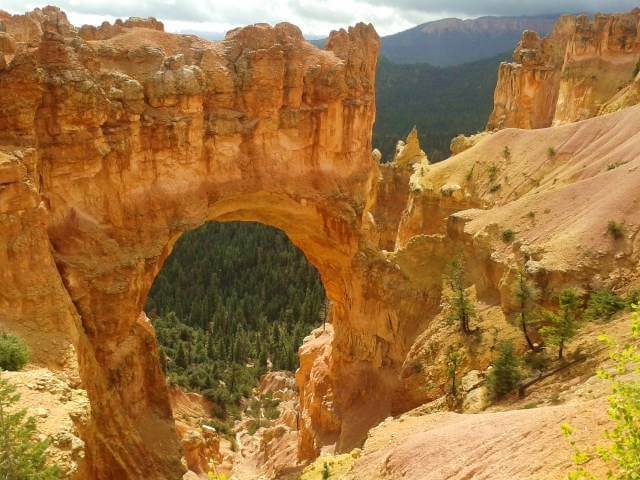
I then got back in the car and drove to the Natural Bridge. Natural bridge is a 85ft arch that has been eroded by water running down and eroding the rocks over millions of years and finally forming an arch. Eventually the arch will erode and collapse as has happened in many places in the park.
Agua Canyon
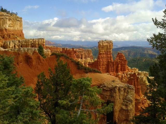
At agua canyon there are 2 distinct hoodoos. Hoodoos are tall, thin spires of rock. Typically in Bryce Canyon if there are 2 hoodoos next to each other then they are left over from when there was an arch there previously.
The towers were named years ago as The Hunter and The Rabbit, though you over the years as the hoodoos have eroded more, sometimes they look nothing like what they were originally named after.
Ponderosa Canyon

From here you have a view of Grand Staircase National Monument. Due to the lack to vegetation here the area is eroded very quickly with the rain, forming rounded domes, pointed nipples and deep canyons.
This canyon was named Ponderosa Canyon because of the huge Ponderosa pines on the canyon floor, with some over 150ft high.
Yovimpa Point and Rainbow Point
At the end of the 18 mile road you will get to Yovimpa Point and Rainbow Point which is the highest point in the park at 2,778 metres above sea level.
From Rainbow Point you can see the whole park stretching out before you and from Yovimpa Point you can see the series of rocks named the Grand Staircase, where you can see the different series and colours of rock as they get closer to the canyon floor.
Here you can do the short Bristlecone Loop, which is a 1 mile hike through the forest with amazing views.
The Riggs Spring Loop Trail is a 7.5 mile hike that you can do from Rainbow to Yovimpa Point, going deep into the canyon it is a difficult hike.
The Under the Rim Trail also starts here and takes you 23 miles back to Bryce Point, it is a difficult hike and you will need to camp to do this hike, after buying your permit from the visitors centre.
Bryce Amphitheater
Bryce Amphitheater has to be the highlight of the park as you look out at the amazing views of Bryce Canyon.
Here there are places to stop in the park, Bryce Canyon Lodge & Sunset Motel and there are also campgrounds and a general store.
Here you will find parking but it can be hard to find a space if you do come later in the day.
If you are there in summer you will find that certain areas of the park are closed and you will need to get the Bryce Amphitheater shuttle, this has stops at Bryce Point, Inspiration Point, Sunset Point, Bryce Lodge, Visitors Centre and Sunrise Point. The shuttle bus runs every 15 minutes.
You can walk along the rim and get the shuttle bus back or do one of the other hikes down into Bryce Canyon.
Bryce point bryce canyon
Bryce Point is famous for its amazing sunrises and it has the best view of Bryce Amphitheater. At sunrise the hoodoos look as if they are on fire when the suns rays catch them.
The Peek a boo Trail starts here, it is a 5.5 mile difficult hike, spent in the canyon with an elevation difference of nearly 500 metres. It is a beautiful hike though as you pass by the Three Wise Men and Wall of Windows. Expect to take around 4-5 hours doing this hike.
The Rim Trail also starts here and you can walk along the rim to Fairyland Point which is a total of 11 miles and will take around 7.5 hours, there is an elevation difference of around 360 metres on this hike but it is still classed as one of the easiest hikes.
The Bryce Amphitheater Traverse starts at Bryce Point, goes along the Peekaboo trail, then to Queens Garden and finishes at Sunrise Point. In total it is 4.7 miles and should take you around 3-4 hours.
Sunset Point
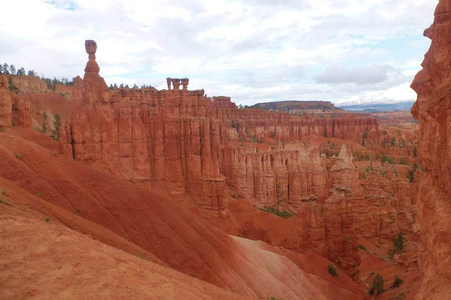
Sunset Point has some of the most amazing views of the hoodoo’s in the park, with Thor’s hammer standing out and one of the most popular attractions of the park.
The easiest hike in the park Sunrise to Sunset, starts at Sunset point and finishes at sunrise point. It is a 1 mile round trip and the path is paved the whole way. You are walking along the rim and so it is fairly flat with only a 10 metre change in elevation.
The most popular hike in Bryce Canyon is the Navajo loop. It is a 1.3 mile that goes down into the valley with an elevation difference of 168 metres. Here you can see “Thors Hammer” “Wall Street” and “Two Bridges”, it is a great hike and is often combined with the Queens Garden Trail.
You can also combine the Navajo/Peekaboo loop starting from Sunset Point and finishing at Bryce Point. This is classed as a difficult hike and is 5 miles long with an elevation difference of 482 metres.
The Figure 8 combination combines Queen’s, Navajo & Peekaboo Loop and is 6.4 miles in total. It’s not an easy hike but should only take around 4-5 hours to complete.
Sunrise Point Bryce Canyon
Sunrise Bryce Canyon has a view to the norteast that captures Boat Mesa and Sinking Ship.
A popular hike is the Queens Garden Trail, it starts at Sunrise Point and you can finish at Sunset Point and combine it with part of the Navajo Trail. It is a 2.9 mile trail with an elevation difference of 183 metres. It is a beautiful hike to do and gets it’s name from the hoodoo that is shaped like a statue of Queen Victoria in London.
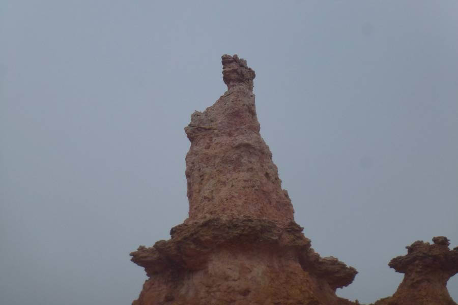
Some people even think the Queen is riding an animal. Eventually though with rain and erosion this hoodoo will change so that it’s no longer recognisable as Queen Victoria.
The Queens/Navajo Combination Loop is the most popular trail in the park, it is recommended to do clockwise and is nearly 3 miles long.
From sunrise point you can also hike to Tower Bridge, it is a 3 mile hike there and back, with an elevation difference of 245 metres.
Fairyland Point
Fairyland Canyon is located a mile before the entrance to the park and you can see the hoodoos at eye level. In the past it was thought that they were indians who had been turned to stone.
From Fairyland Point you can start the Fairyland Loop hike. It is a difficult 8 mile hike and will take you around 4-5 hours. It combines hiking along the plateau rim and down into the canyon to see unique hoodoos. The elevation difference on this hike is 523 metres.
Mossy Cave
Mossy Cave is outside of the park on Highway 12 and saw it while on my road trip through Utah from here is the option of doing the Mossy Cave Trail. It is less than a mile long and in summer you see the dripping moss and in winter amazing icicles.
Where to stay when visiting Bryce Canyon
The closest place to stay to Bryce Canyon National Park is in Bryce Canyon. It is around 3 miles from the entrance to the park.
A great option here is the Best Western Plus Bryce Canyon Grand Hotel, it includes a hot breakfast and an outdoor pool and jacuzzi, perfect for relaxing in after a day hiking. Click here for more details and prices.
Need help planning your trip to Utah, then check out these other guides:
- Plan your Zion National Park Itinerary
- What to do in Arches National Park
- Everything you need to know about Canyonlands National Park
Save it for later.

Like with many states, I only saw the main city in Utah. Bryce Canyon has been on my list for a while.
I must admit that I’ve never heard of Bryce Canyon before reading this post, but what an incredible sight! Seeing more places like this in the US is high on my list. I’m adding this to the list!
What a great, thorough review of Bryce Canyon. I visited Zion quite a few years ago but have never been to Bryce. I’m not much of a hiker these days but some of the easier hikes sound doable.